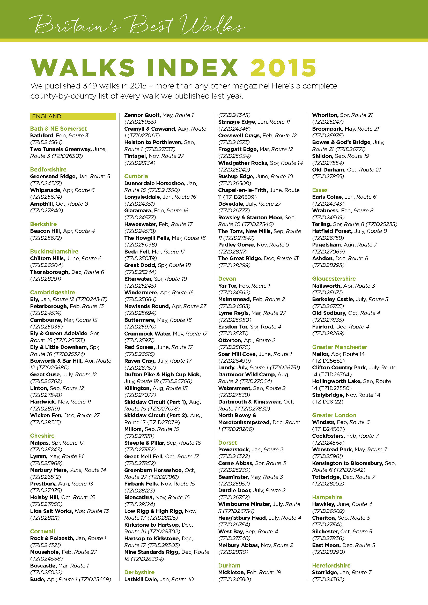
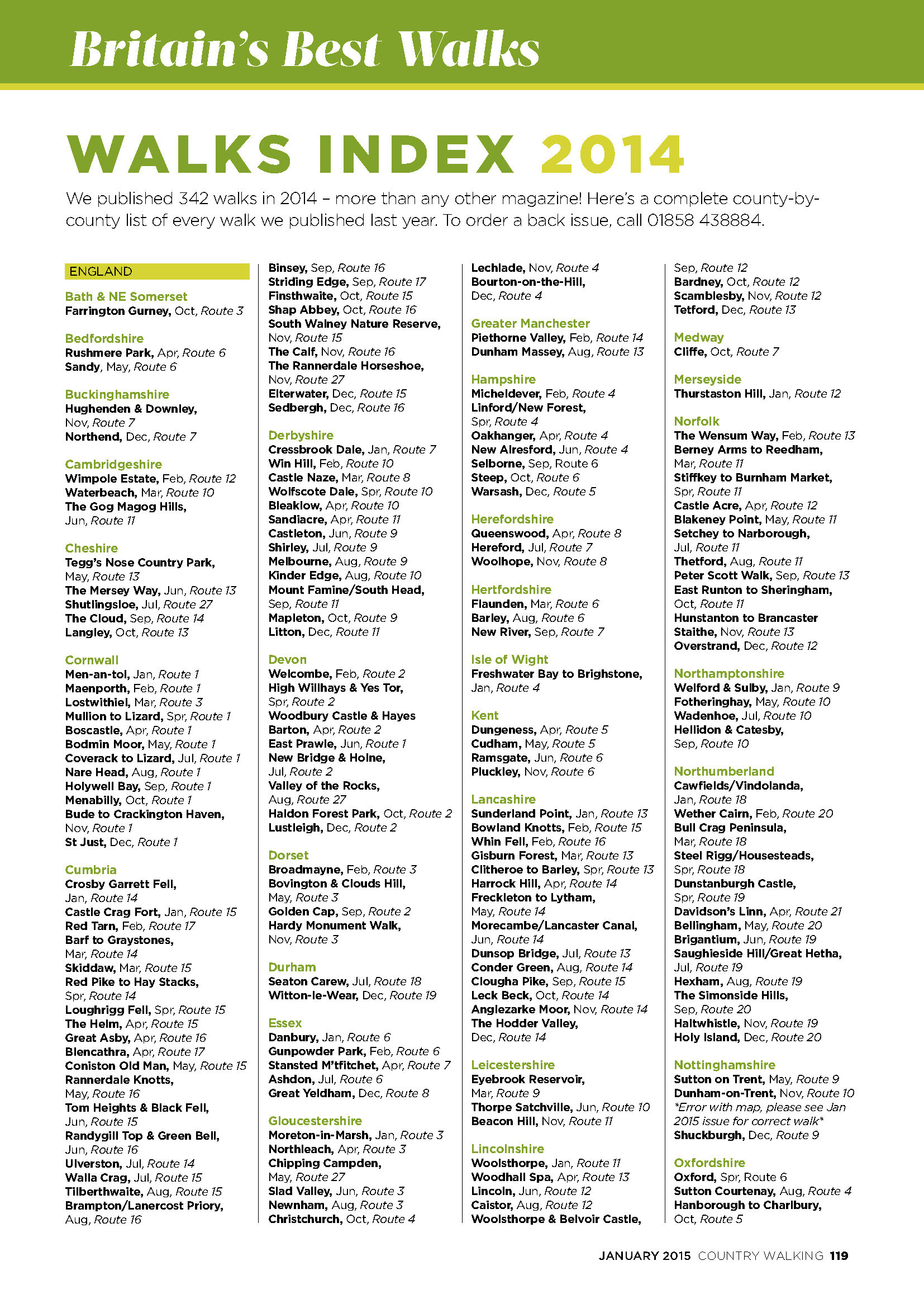
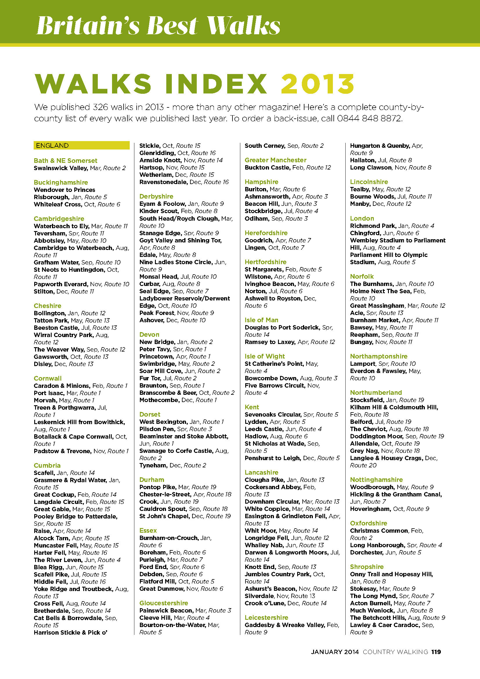
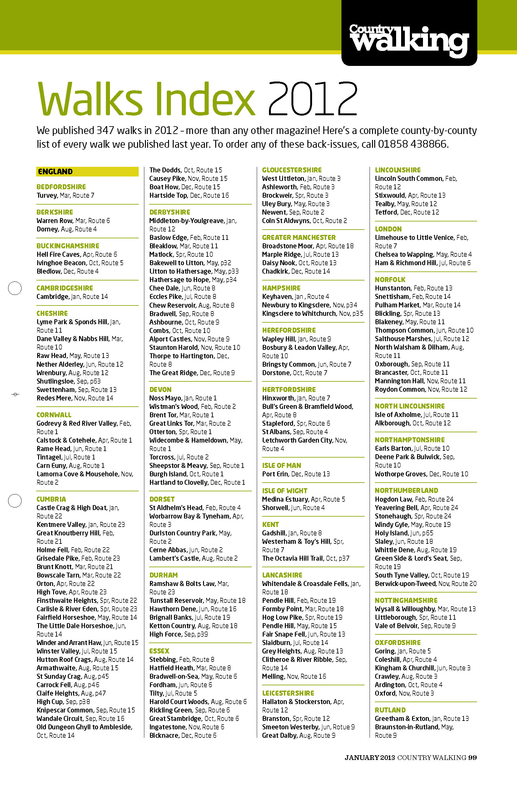
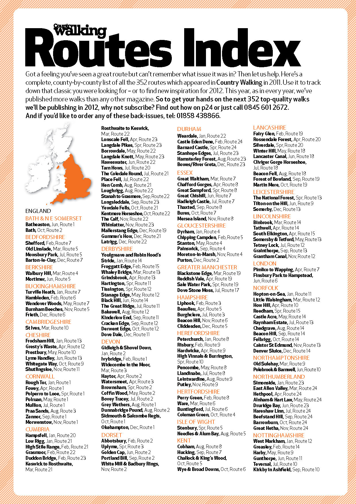
ROUTES INDEX
Use the map below to find every Country Walking route published on OS Maps, plus grades, distances and the publication date. Simply zoom and pan the map to browse, then click on an icon for details. Click the OS Maps link to access an online version of the route.
The map on this page features routes published in the last three years, but if you click the square in the top-right corner of the map, a larger version of the map will load and you can then select more years in the left-hand panel.
Our routes are graded Easy, Moderate, Challenging and Extreme, depending on distance, terrain, elevation and ease of navigation. Easy and moderate walks are usually less than 8 miles with relatively gentle gradients and good paths. Challenging walks are usually longer, with greater ascent and can also involve more demanding terrain or difficult navigation.
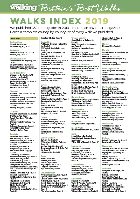
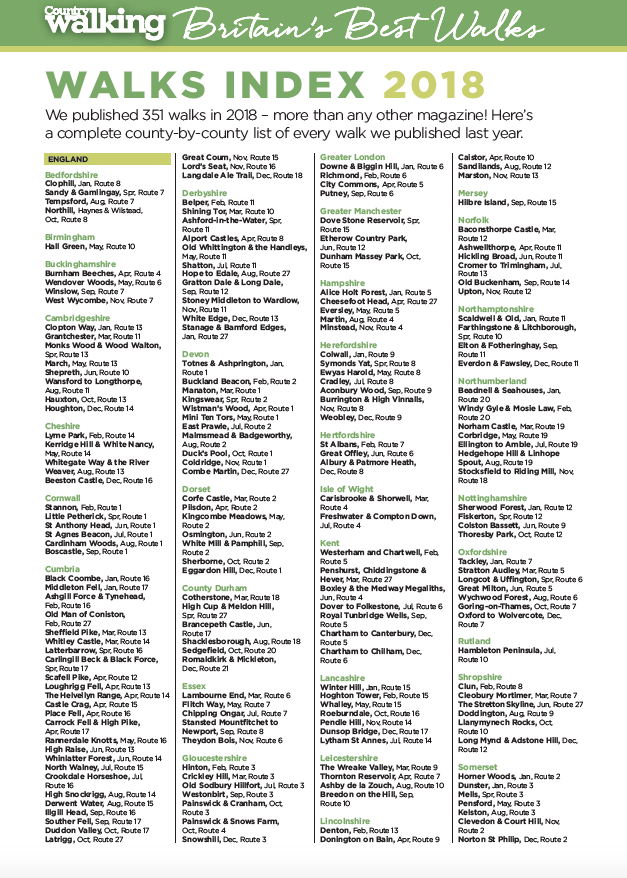
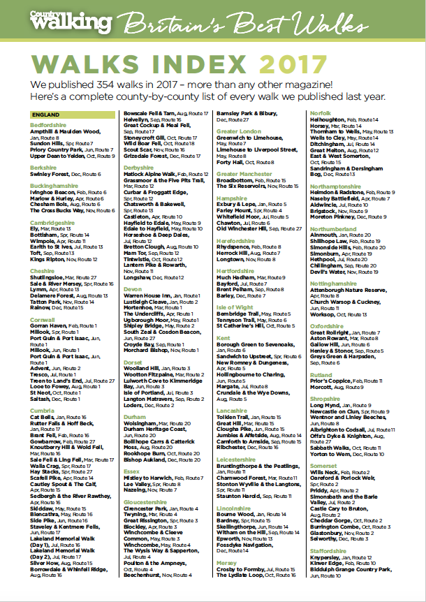
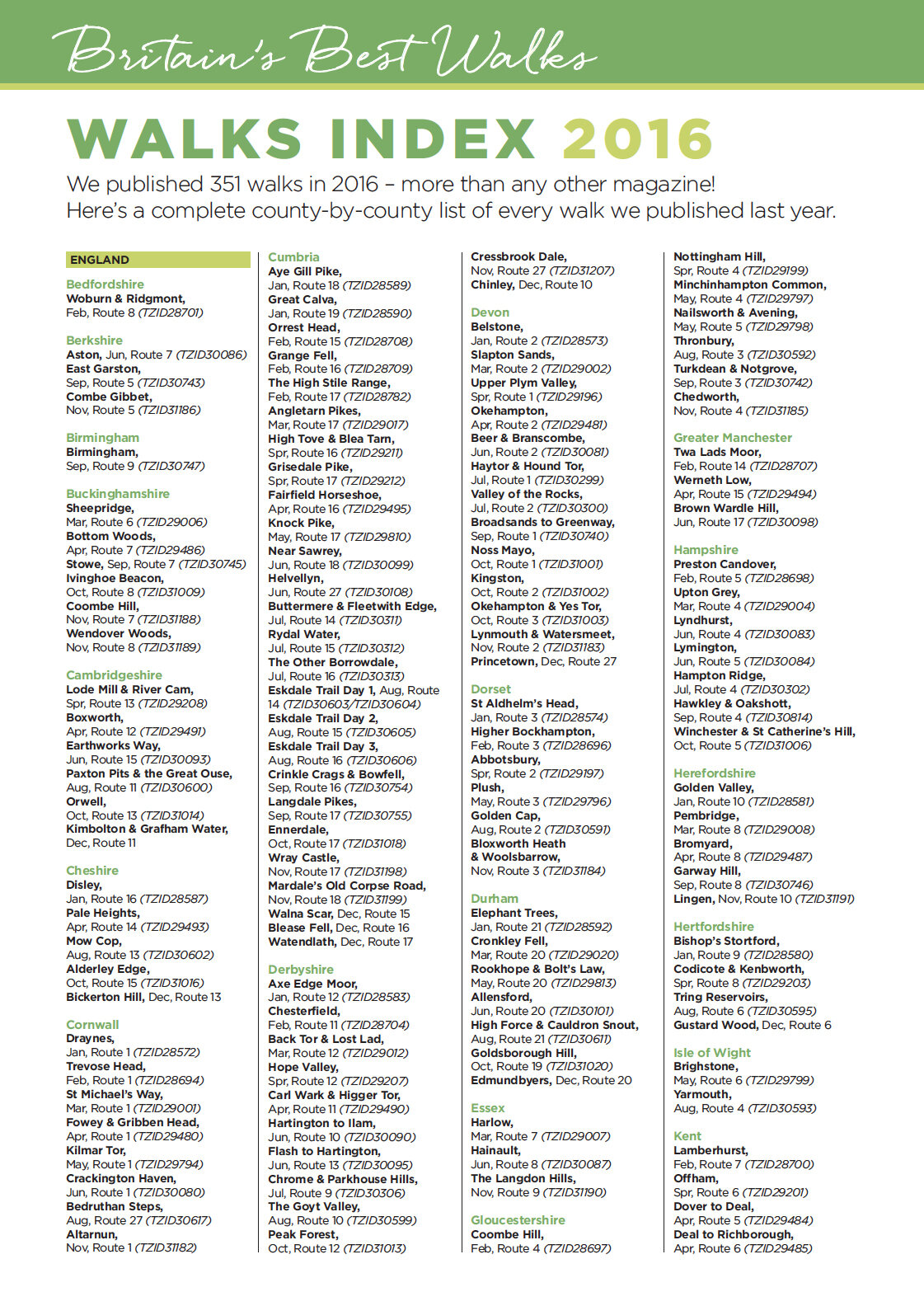
Annual Index Cards
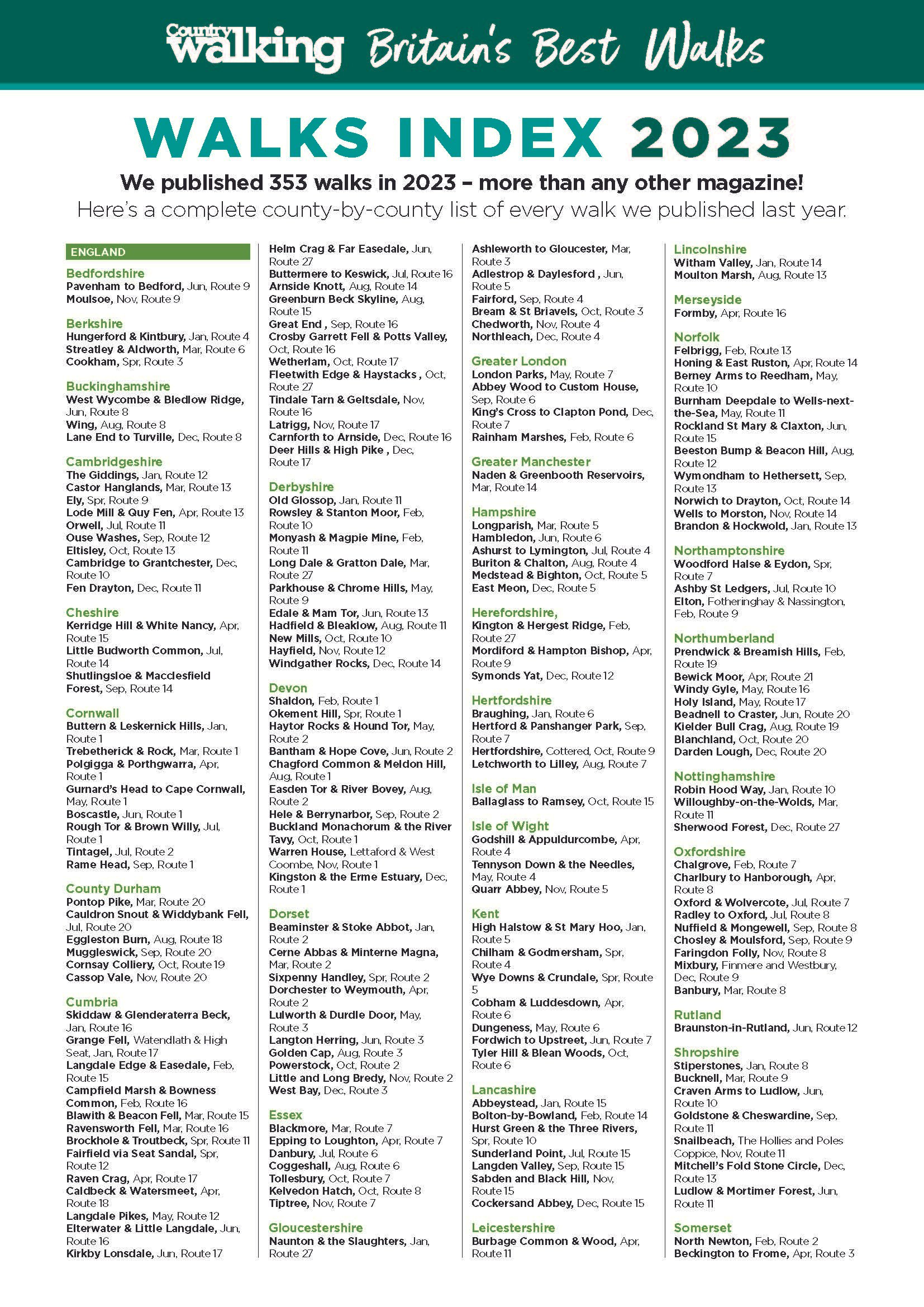
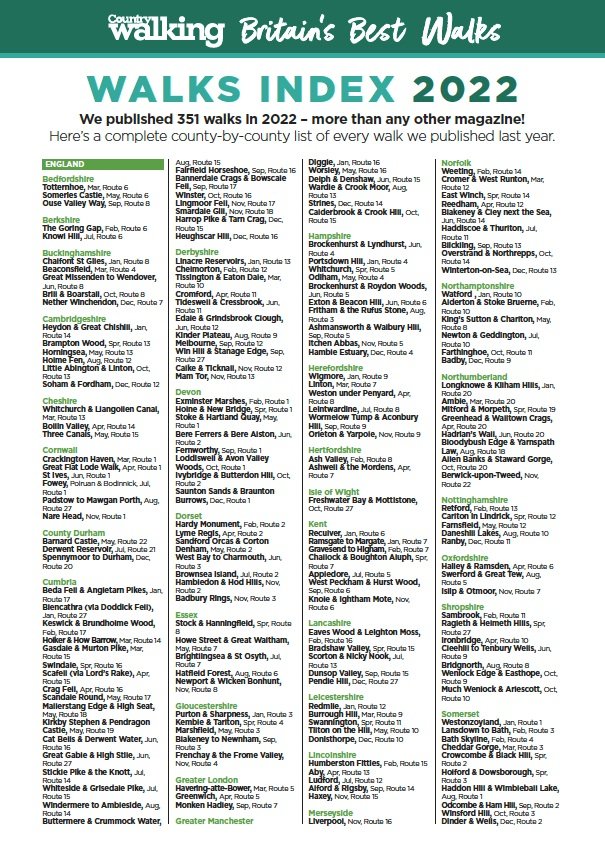
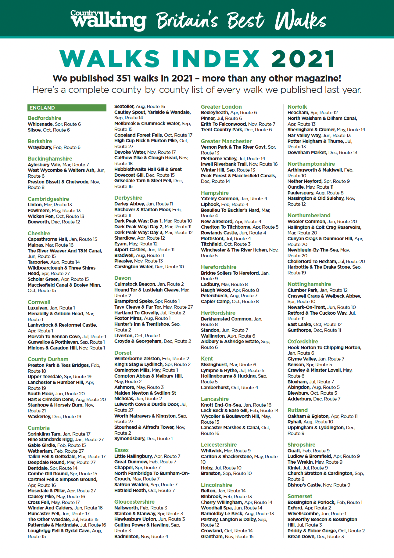
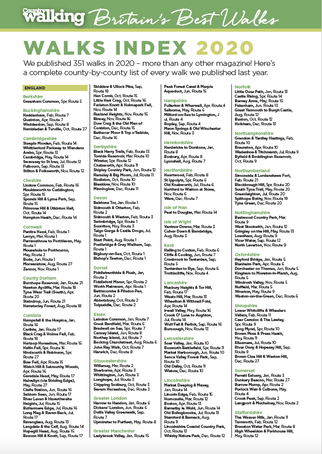
We no longer produce annual index cards, but below you’ll find all the cards from between 2011 to 2023. Just click on each image to open the document.
To order a back issue, call 01858 438884 or email: bauer@subscription.co.uk